Airports are complex and dynamic places. Just a slight wind shift can change the runway in use, and the traffic patterns planes must fly. Pilots are expected to enter these changing environs fully abreast of what is going on and where. How do they do it?
Table of Contents
What Is ATIS in Aviation?
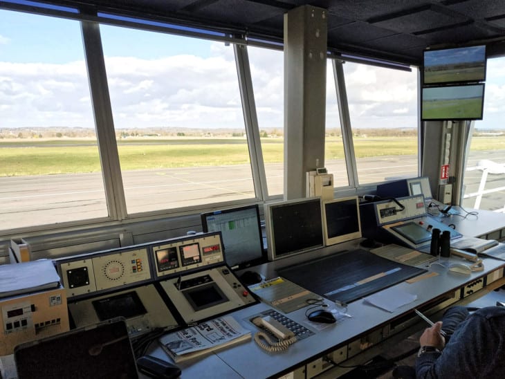
The answer is the airport’s automated terminal information service (ATIS). The ATIS is a message to pilots, recorded by the air traffic controllers every hour, and broadcast on a specific VHF radio frequency. The message contains all the essential information about airport operations that a pilot might need to know.

What Information Does ATIS Provide?
The terminal broadcast is standardized, so pilots can easily understand them no matter where they are operating. The necessary parts of an ATIS are as follows.
- Name of the airport
- Information letter identifier
- Time of the weather observation in Zulu time
- Wind direction and speed
- Visibility
- Precipitation or weather phenomena (rain, fog, smoke, etc.)
- Cloud conditions and cloud base heights
- Temperature and dew point
- Field altimeter setting
- Instrument approach(es) in use
- Taking off and landing runway(s) in use
- Any pertinent Notices to Airmen (NOTAMs), like a TFR
- Precautionary statements
- Information letter identifier repeated.
How Often is ATIS Information Updated?
ATIS information is usually updated during the last ten minutes of every hour.
If any critical piece of the information changes, though, the controllers can update the ATIS at any point they need to. This is especially important if the wind shifts from a different direction, changing the runways or instrument approaches in use. It’s also handy if the weather deteriorates below basic visual flight rules (VFR) flying.
ATIS versus ASOS/AWOS
ATIS broadcasts are a staple of towered airports. Before there were ATIS broadcasts at these airports, controllers were required to ensure that each pilot knew significant weather and field information, like the current altimeter setting and wind direction.
Now that this information is recorded on the ATIS, the controllers only need to say things once. ATIS reduces controller workload and frees up the radio frequency for more critical communications. That’s very important at busy airports.
To ensure that the pilot has received and understands the ATIS, each hourly broadcast is identified with a letter of the phonetic alphabet. Pilots must state that they have the current information upon their first contact with the control tower. By saying the they “have Information Alpha,” for example, a pilot is telling the controllers that they have listened to the ATIS broadcast.
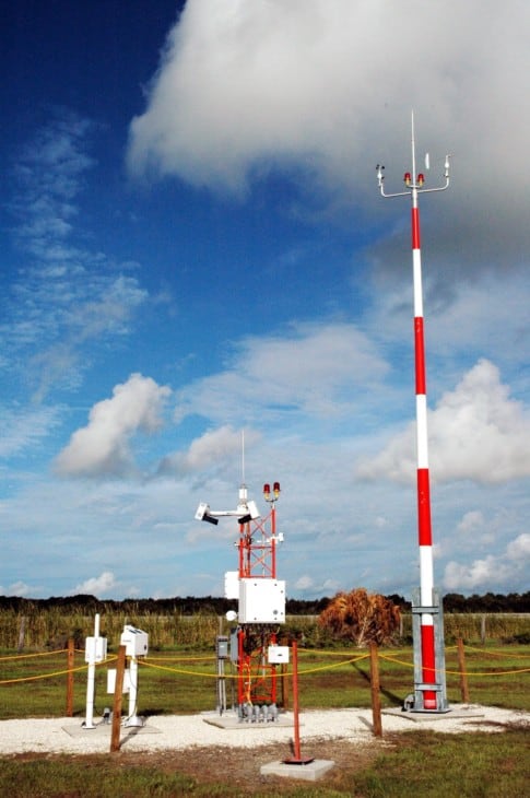
At non-towered, or uncontrolled, fields, pilots often monitor the ASOS or AWOS to receive weather information. These are computer-generated voice transmissions directly from weather sensors on the ground. ASOS stands for automated surface observation system, while AWOS means automated weather observation system. They are very similar to one another.
These automated sensors update continually, so the pilot has an instantaneous read of the weather. However, they aren’t double-checked by a human, so sometimes sensor errors or glitches result in the information not being entirely correct.
Both ASOS and AWOS systems are installed at most airports. Even at towered airports, controllers are often getting their weather data from an ASOS or AWOS.
A neat function of these computer-based systems is that, in many cases, pilots can call a phone number to hear them. That way, they can check the weather at non-towered airports with no other weather reporting before they depart on a long flight.
D-ATIS
In the modern age of texts and emails, voice recordings might seem a little old school and inefficient. For pilots, ATIS recorders are usually spoken at lightning speed by controllers who are in a hurry. Digesting and remembering the pertinent details requires learning to write down the information in some form of short-hand.
Larger airports have begun using Digital ATIS (D-ATIS) systems. For pilots, this means that the ATIS information is received on their cockpit instruments. They can then refer to it as needed. So there is no more struggling to hear mumbled voice broadcasts and writing down long-winded ATISs.
Real-World ATIS Example
Here is an example of a typical ATIS information broadcast from Daytona Beach International Airport in Florida. This is a very typical example of the hourly broadcast heard at most towered airports. The full transcript of the video broadcast is below. How many times would you have to listen to get all the details down?
“Daytona Beach International Airport, Information Lima, Time 1753 Zulu observation.
Wind 060 at 16 gusts 24.
Visibility 10.
Few clouds at 3,500. 7,500 scattered. 9,500 broken.
Temperature 27, dew point 18.
Altimeter 30.18.
Remarks: Rain showers vicinity—northeast, southeast.
Visual approach in use, landing Runways 7 Left and 7 Right. Approaches being conducted to parallel and intersecting runways. Aircraft assigned to Runway 7 Right, tower frequency 118.1.
NOTAMS: Hazardous weather information affecting Florida and coastal waters available on HIWAS, Flight Watch, or Flight Service.
Taxiway November, non-standard markings on west side of Runway 16-34.
280-foot crane, 3,300 feet north of the approach end of Runway 7 Left. Crane, 1000’ north of the Runway 25 Right threshold.
Land and hold short in operations in effect: available landing distance to land Runway 7 Left to hold short of Taxiway Whiskey is 7,500 feet. Read back all runway hold short instructions and runway assignments. All departures contact Clearance Delivery on 119.3 prior to taxi.
Advise controller on initial contact that you have Information Lima.”
Related Posts
